Driving Highway 1: Monterey, Big Sur, and the coast south to Santa Barbara
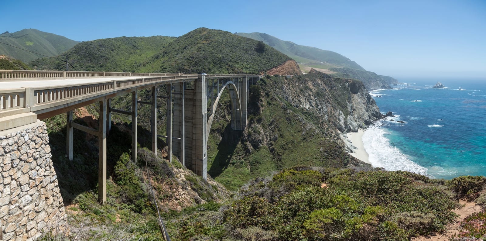
Let the road status decide the shape first. While the September fire closures remain, keep the trip around open Monterey/Carmel or Santa Barbara stops and postpone the Big Sur through-drive and lodge overnight. After official reopening, the one-day plan can combine Point Lobos, Bixby Bridge, the Pfeiffer redwoods and a walk-in Nepenthe lunch, with McWay Falls only where access is permitted. With two days, a reopened Big Sur Lodge offers the quiet morning coast before continuing south. In winter or after a storm, recheck Caltrans and keep an out-and-back from Carmel as an alternative only where roads and stops are open.
Travelers who want the drive itself to be the trip, not a fast link between two cities.
Anyone deciding between a one-day highlight run and a two-day version with a Big Sur overnight.
Drivers who want the gas, signal, parking, and closure facts before they leave pavement they know.
Tradeoffs
A one-day drive sees the headline pullouts but rushes Big Sur; a two-day version costs a Big Sur room but buys sunrise and sunset on empty road.
Big Sur lodging is limited and expensive, so the payoff for staying is the quiet hours, not a bargain.
The northern (Monterey/Carmel) and southern (Santa Barbara) bases are both strong, but they set which direction and which half of the coast you see in good light.
Let the road status decide the shape first. While the September fire closures remain, keep the trip around open Monterey/Carmel or Santa Barbara stops and postpone the Big Sur through-drive and lodge overnight. After official reopening, the one-day plan can combine Point Lobos, Bixby Bridge, the Pfeiffer redwoods and a walk-in Nepenthe lunch, with McWay Falls only where access is permitted. With two days, a reopened Big Sur Lodge offers the quiet morning coast before continuing south. In winter or after a storm, recheck Caltrans and keep an out-and-back from Carmel as an alternative only where roads and stops are open.
Comparisons
Choose the lane by constraint
One-day highlight drive vs two-day with a Big Sur nightThe difference is not distance but light and crowds: the overnight buys the coast before and after the day-trippers.
One day: After access reopens: use a single day when Big Sur is one part of a longer California trip: leave Monterey by 8 a.m., keep stops short, and end back in Carmel or push to San Simeon.
Two days: After access reopens: use two days when the drive is the point: overnight at Big Sur Lodge or in Carmel so you drive the cliffs at sunrise and sunset with far less traffic.
Tie breaker: If you would resent paying for a Big Sur room, do the one-day version well rather than a two-day version cheaply.
North-end base (Monterey/Carmel) vs south-end base (Santa Barbara)Both anchor the drive; the choice sets your direction and which end gets your fresh morning.
Monterey or Carmel: Base north when you want the aquarium, Point Lobos, and Big Sur first, and you are continuing south afterward.
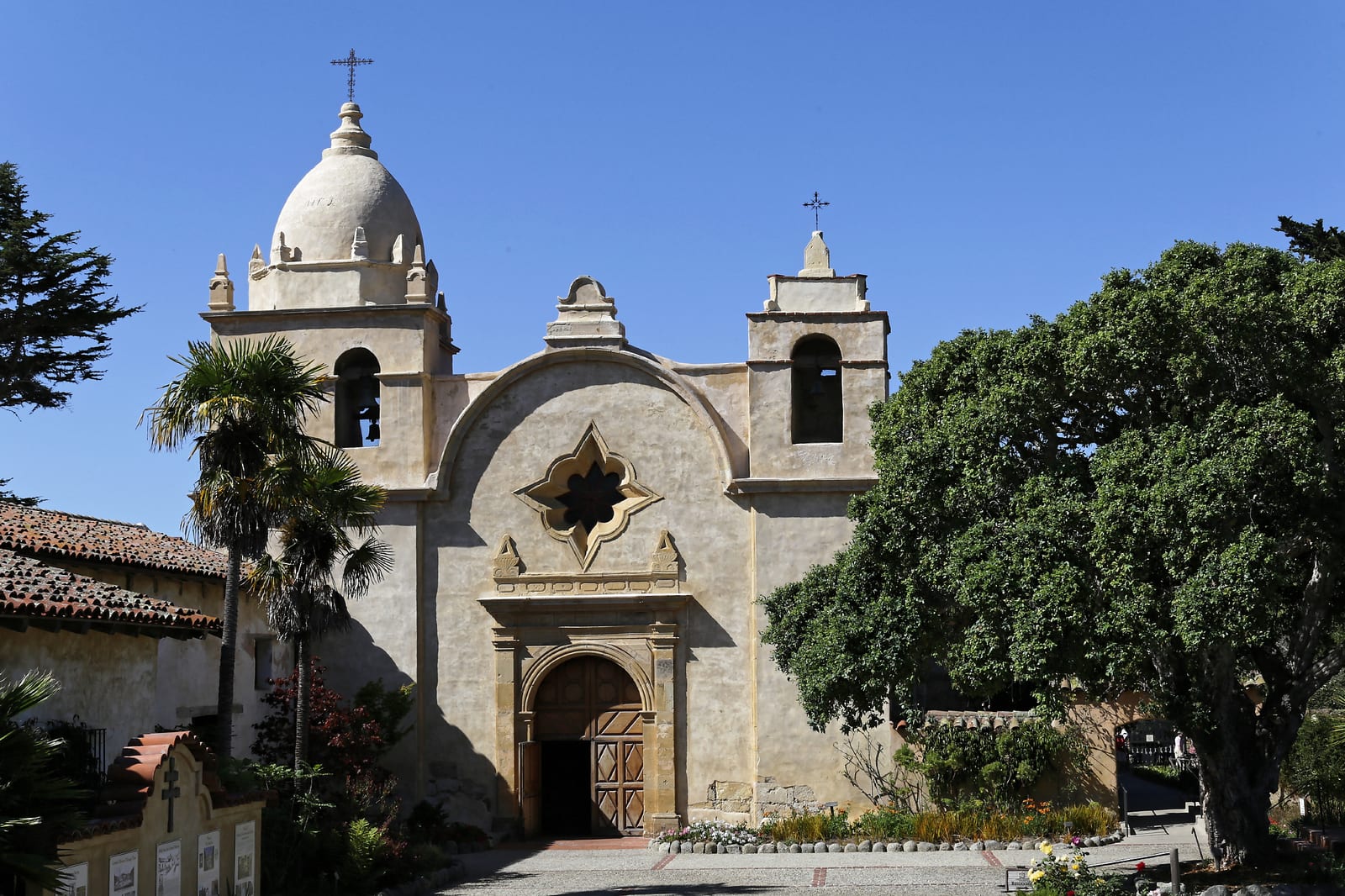
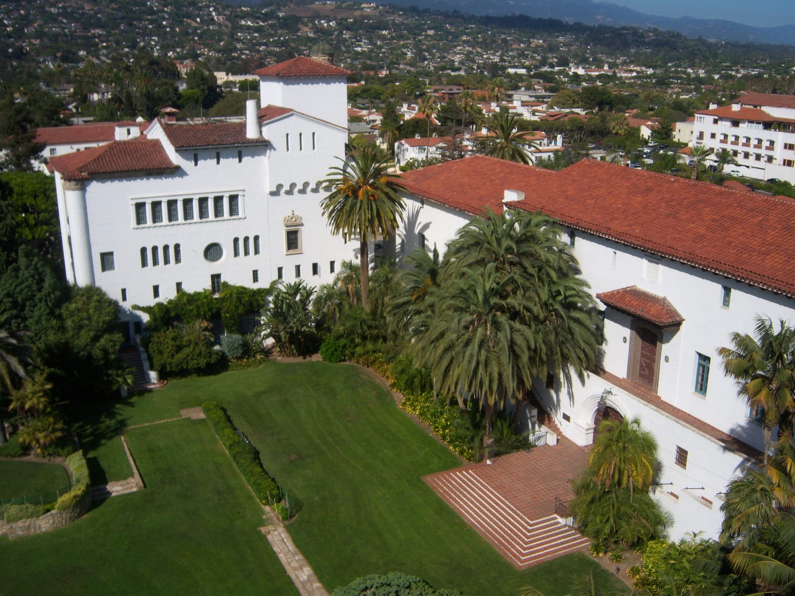
Santa Barbara: After access reopens: base south when you are coming up from Los Angeles and want State Street, Stearns Wharf, and the Mission as the anchor, driving Big Sur as a longer day trip north.
Tie breaker: Point-to-point travelers should base at whichever end they are not flying into, so the drive connects the trip instead of doubling back.
Through-drive vs out-and-back from CarmelFuel and signal anxiety, not scenery, usually decides this one.
Through-drive: Use the through-drive only after Caltrans confirms the whole route is open, with a room booked south, fuel in the tank and offline maps downloaded.
Out-and-back: Use an out-and-back from Carmel when the northern road and your chosen stops are open. Do not treat it as permission to enter a closure or evacuation area.
Tie breaker: If limited services and patchy signal make the group uneasy, keep Carmel as the base and choose confirmed open northern stops.
Quick plan
Fix the direction and base, confirm the road, then fuel up before the empty stretch.
Step 1Set direction and baseDrive north to south for easy coast-side pullouts, and pick a Monterey/Carmel or Santa Barbara base depending on which end you fly into.
Step 2Check the road and park statusLook at Caltrans QuickMap for Big Sur one-way controls and confirm the state parks and McWay Falls overlook status the morning you drive.
ScenarioNo reservations, arriving same dayFor open venues, Nepenthe normally takes walk-ins and state-park day use is generally first come. Current fire closures override ordinary hours and admission rules; check access before leaving.ScenarioWinter or after a stormCheck Caltrans QuickMap before leaving: one-way controls and weather closures move week to week, so keep Carmel as a fallback base and do an out-and-back rather than committing to a through-drive.ScenarioWorried about gas and cell signalFuel stops are limited and cell coverage can drop out. Fill up before the Big Sur corridor, download offline maps and choose open northern stops if the group prefers a shorter outing.
Rain and heat planFog and rain change the drive more than they cancel it: the coast is often socked in until midday, and wet cliffs make the pullouts slower, so build slack and keep indoor anchors on the list.
On a foggy morning, start indoors at the Monterey Bay Aquarium and let the marine layer burn off before you drive the cliffs, rather than fighting whiteout at the overlooks.
After rain or during fire activity, confirm park and road access before leaving Carmel. Skip closed trails and do not count on a roadside McWay Falls stop being available.
The single most useful decision is to drive north to south and to give the drive real time.
Carmel to San Simeon is only about 90 miles, but nonstop it is roughly two to two and a half hours on a winding two-lane road, and realistically a half or full day with stops and one-way controls.
Drive north to south so the ocean and its pullouts are on your right, and start early: Point Lobos and Nepenthe both fill by late morning.
If you only have a day, accept that Monterey-to-Santa Barbara in one push wastes the best of Big Sur; pick the northern core or the southern town, not both.
CalibrationKeep the drive framed as a slow scenic day, not a transfer, so readers plan enough time.
Editorial read
Road status, gas, and signal in Big Sur
The corridor needs time for narrow curves, traffic controls, limited services and changing closures.
Checked September 12, 2026: Caltrans reports a wildfire closure between Los Burros and Kirk Creek Camp. Highway 1 is not currently a through-route; Pfeiffer Big Sur State Park and Big Sur Lodge are also temporarily closed. Caltrans also lists one-way control at Rocky Creek Bridge; use its current bulletin rather than a fixed delay estimate.
Fill up in Carmel heading south or Cambria heading north. Big Sur has some fuel stations, but they are sparse and may be affected by road closures; do not plan on every station being available.
Cell signal is minimal to none between the village and Lucia, so download offline maps and do not count on live closure checks once you are on the cliffs.
CalibrationTreat road, fuel, and signal as hard constraints, not footnotes, because they shape the whole day.
Editorial read
The stops that earn their pullout
A handful of anchors carry the drive; the rest is the road itself.
Point Lobos is the first major coastal walk south of Carmel, with a published $10 vehicle fee. Pfeiffer Big Sur is the redwood-and-river stop with Big Sur Lodge on site, but both are temporarily closed during the fires.
Checked September 12, 2026: Julia Pfeiffer Burns is only partly open. Trails east of Highway 1 and the McWay Falls overlook trail are closed; there is no beach access. Follow current park and road restrictions.
At the south end, Stearns Wharf and lower State Street give Santa Barbara a walkable finish after the cliffs.
CalibrationKeep the anchor stops distinct by payoff — walk, redwoods, waterfall view, town finish — rather than listing every pullout.
Partner links
Compare bookable Monterey and Carmel activities
Use the road and overnight logic above first, then compare live Monterey, Carmel, and Big Sur activities that fit the driving day you actually chose.
This is an affiliate link to the third-party GetYourGuide marketplace. If you book after clicking, California Guide may earn a commission at no extra cost to you. It is not an official ticket desk, and listings, prices, availability, and terms can change. The editorial guidance above was selected independently of commission.
GetYourGuide marketplace
Explore Monterey and Carmel activities on GetYourGuide
Compare current coastal tours, whale watching, cycling, and family activities, availability, and inclusions.
Best for: One guided or ticketed slot after the itinerary is settled.
Third-party GetYourGuide marketplace, not an official ticket desk. Check the operator, meeting point, inclusions, accessibility, and cancellation terms.
Use the guide above to decide what fits; use these links only to compare live bookable options. Check official venue and transport sites for current rules.
QuestionIs Highway 1 through Big Sur open in 2026?Checked September 12, 2026: Caltrans reports a wildfire closure between Los Burros and Kirk Creek Camp. Highway 1 is not currently a through-route; Pfeiffer Big Sur State Park and Big Sur Lodge are also temporarily closed. Regent’s Slide reopened in January 2026, but that historical reopening does not guarantee current through access. Check Caltrans on the day you drive and use its advised alternative route.QuestionCan I see McWay Falls at Julia Pfeiffer Burns?Checked September 12, 2026: Julia Pfeiffer Burns is only partly open. Trails east of Highway 1 and the McWay Falls overlook trail are closed; there is no beach access. Follow current park and road restrictions. The earlier roadside viewing option depends on permitted access; do not plan it as a guaranteed stop while fires affect the area.QuestionDo I need reservations for Nepenthe or the Big Sur state parks?Nepenthe normally accepts walk-ins rather than reservations, and the listed state parks normally use first-come day admission. Current closures take priority: Pfeiffer Big Sur is closed. Check each operator before planning a stop.QuestionHow long does the Monterey-to-Santa Barbara drive take?Carmel to San Simeon alone is about 90 miles and roughly two to two and a half hours nonstop, but realistically a half or full day with stops. Monterey to Santa Barbara in one day is possible but rushes Big Sur — plan an overnight if you want to do it well. This timing assumes the road is open; it does not apply to the current wildfire closure.